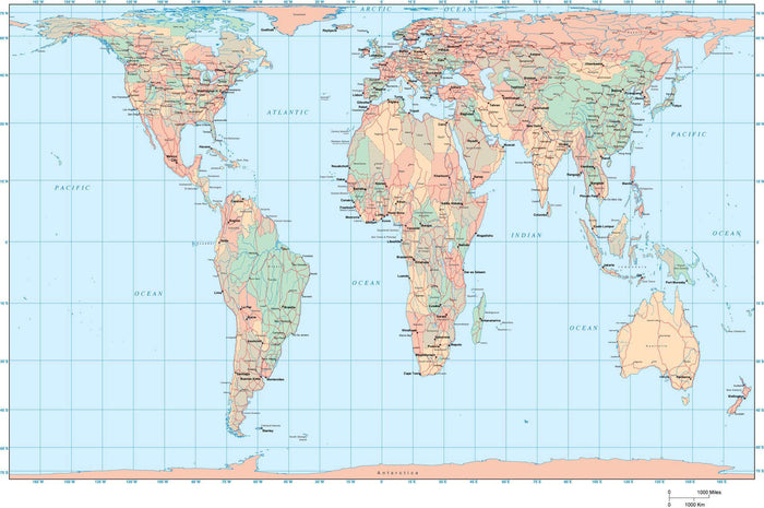
World Map - Europe / Africa Centered - Gall Projection
World Map - Europe / Africa Centered - Gall Projection
Regular price
$155.96
Regular price
$155.96
Sale price
$199.95
Unit price
per
Excellent 4.9
19,544 Reviews
Trustpilot
465 sold in the past 24 hours
401 people are viewing this item
Only 1% left in stock
BUNDLE & SAVE
Couldn't load pickup availability
-
Ordered
- - -
Order Ready
- - -
Delivered

World Map - Europe / Africa Centered - Gall Projection
Regular price
$155.96
Regular price
$155.96
Sale price
$199.95
Unit price
per
About This World Map in Gall / Peters Projection
Shows country borders country names US states, Canadian provinces, major rivers, lakes, roads, and cities.
In Illustrator format each country is a separate object you can select and change color. All lines are fully editable, and all text is fully editable font text (not outlines).
This world map is in the Gall Projection, which is virtually identical to the Peter or Peters world map projection.
Drawn at a nominal size of 17 x 11 inches. Perfect for large color illustrations in print or web design.
Collapsible row
Collapsible row